Geographic data management, analysis, and visualization are important parts of utilities management. Using GIS systems for mapping utility locations and keeping track of data comes with many benefits, and access to powerful geoprocessing tools and services is one of them.
Geoprocessing
Geoprocessing is basically the manipulation of spatial/GIS data to manage geographic data, create models, and perform analyses. It resides within a general GIS workflow, playing a primary role in GIS data processing and dynamic spatial analysis.
Data Preparation
There is variety in the type of data that can be processed in geoprocessing. These include data sets like raster data, vector data, and feature class.
After data has been collected and entered into the system, it needs to be checked for errors and formatted correctly to perform the actions or analyses needed. Often, data may need to be extracted from different datasets or combined together with others. This manipulation of data can be successfully performed by geoprocessing tools.
Analysis
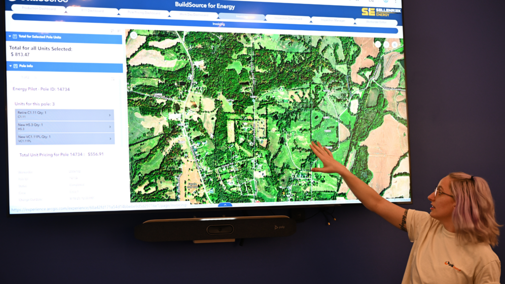
After data processing, analyses can be performed in the appropriate way to answer the questions being asked or to display trends and facts needed to plan work operations. Depending on the need, different features, map overlays, and spatial details can be used to answer questions related to the geographic data. For example, if your goal was to identify what regions have a higher density of underground utilities. Using GIS data and utilities data, analyses can be performed and geoprocessing results will reveal the answer and even a digital map to view.
Building a Geoprocessing Framework
Workflows for geoprocessing can be created to automatically run strings of geoprocessing tasks in the same sequence. This is done by selecting the appropriate tools needed to process your work and setting them up in a framework. Most often, the output from the first tool in the sequence serves as input for the next tool and so-on until the objective is reached.
Once the workflow has been created, your geoprocessing setup should be able to automatically operate to perform the necessary tasks and return results upon entering in the input data.
Tools for Geoprocessing
There are various tools that can be used to run the tasks needed to perform geoprocessing.
Understanding and selecting the right tools is important for running your geoprocessing workflow and managing your spatial data correctly. Pre-made tools are available through programs like arcGIS desktop and web applications, but they can also be customized to fit your needs and enhance the automation of your workflow.
The buffer tool is an example of a widely used geoprocessing tool. The buffer can build a proximity around a specified collection of features, and also at a set distance around these features. Another tool, the dissolve tool, can remove boundaries for locations with common features. For example, removing state boundaries to just show the US continent.
Geoprocessing Services
Creating a geoprocessing system for your data may seem to be a daunting task, especially if you are unfamiliar with GIS and map services. That is where geoprocessing services come into play. A geoprocessing workflow can be compiled into a package to share with others. Also, web services or applications can also be created from your geoprocessing framework.
Geoprocessing services are web-based applications that already contain the sequence of tasks and tools needed to manage a particular type of data. They are fully automated and ready to go. If you run a company that uses GIS in your day-to-day, there may be a GIS and geoprocessing service right for you and your data.
UtiliSource
Here at UtiliSource, we provide full-service GIS and geoprocessing services for utilities management. Whether you are a small business, large utility company, or a municipality, UtiliSource has the perfect geospatial data management solutions for you.