For utility companies, construction companies, municipalities, and more, having precise location information about underground utility lines is very important. There is an intricate network of utility under our feet. These networks include natural gas lines, sewer lines, water pipers, electric lines, cables, and more.
Mapping underground utilities is extremely beneficial and allows you to carefully identify, locate, and map subsurface lines. GIS mapping allows you to create accurate maps in real time. GIS stands for geographic information systems and greatly aids in the underground utility mapping process.
Utilizing GIS data in utility mapping is important for precise mapping. GIS systems and utility mapping aid in planning and design processes for a variety of projects. From construction, to utility maintenance, to grid expansion, GIS utility maps are extremely important.
Continue reading to learn more about why you should be using GIS utility mapping systems.
Reason 1: Better Decisions
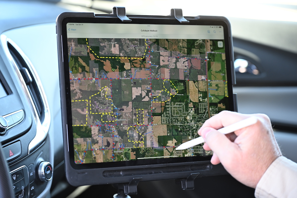
One of the biggest advantages to GIS is that it allows you to make better decisions, faster. GIS utility maps are precise visualizations of the underground landscape. GIS maps can show layers of data at the same time, including zoning information, permitting, development, and more.
These layers can be filtered to show each layer and give crews a better, more complete view of subsurface utilities. Having access to all of this data quickly and easily drives more informed decision making.
Reason 2: More Responsive
GIS can be used to facilitate information sharing and communication between field and back office teams. It allows for easy, real time information sharing between the field and the office. By reducing the need for manual processes and paper processes, you can streamline operations and make more informed decisions, faster.
Reason 3: Real-time Access
GIS systems allow you to access data in real time. Many GIS mapping software have mobile apps that can be used and accessed from anywhere. These systems allow you to view maps, analyze data, and display important information when you need it most.
In addition, you can access different projects and different maps all from one application. Everything is in one, easy-to-navigate application. All of your utility maps are located in one place and can be reached with just one click.
Reason 4: Reduce Costs & Drive Efficiency
GIS mapping can be used to drive productivity and increase operational efficiency. This in turn, reduces operational costs. GIS software alleviates common pain points when it comes to communication across teams and data access.
Because many GIS applications can be accessed from mobile devices, field technicians can easily access and find the most up-to-date information. GIS databases can help you better manage projects, plan maintenance, track inventory, and more.
GIS systems reduce the need for many time-consuming, manual paper processes. It can even automate reporting tasks, such as daily reports and data exports. By automating tasks and streamlining operations with GIS, you can save your teams’ time and save your company money.
Reason 5: Better Asset Management and Operations Management
With GIS, you can improve asset and operations management. GIS maps allow field technicians to easily access information about maintenance and repairs. Utility maps give your field techs the necessary information they need to easily find and service assets. This can save time in troubleshooting and reduce costs by ensuring utilities and assets are easy to find and be fixed faster.


