Utility locating is a critical process and one that needs to be done with accuracy and precision. Knowing what is below the surface of a building or other structure is essential to any project’s success and safety.
GPR, or Ground Penetrating Radar, has become an invaluable tool for utility mapping in recent years due to its accuracy, affordability, and ability to detect numerous types of subsurface utility materials. This cutting-edge technology is used to locate and map underground utilities such as pipes, cables, and even tanks.

GPR at a Glance
Ground Penetrating Radar (GPR) is a high resolution imaging technology used to detect buried objects or other features below the surface. It works by emitting high frequency electromagnetic (EM) waves into the ground, and then analyzes the reflections of those waves off of objects or other features below the surface in order to create an image.
GPR systems are used in a variety of applications, including geophysical surveying, archaeology, environmental studies, utility mapping, landslide detection, and geological prospecting.
GPR Piece by Piece
The first part of GPR equipment is the GPR antenna, or receiving antenna. This emits and receives an electromagnetic pulse that propagates through the subsurface, reflecting off different objects and boundaries and then returns back to the receiver. The signals are analyzed in the radar detector where they are converted from a raw analog signal to digital data that can be analyzed further.
The next component is the GPS receiver which tracks the location of the equipment at different points in time. Finally, the computer is what allows you to operate the equipment, analyze the data and store it in an appropriate format.
The Ins and Outs of GPR for Utility Mapping
GPR utility surveys have become an integral part of surveying underground assets for many utility companies and contractors. This is because GPR methods are accurate, non-invasive, and streamline the locating of buried pipes, cables and other underground assets. There are many benefits of using this technology, saving you time, money, and resources while making sure your utility assets are up to date and functioning safely.
The Ground Penetrating Radar Survey Processes
The GPR utility survey is a simple yet thorough process that begins with the preparation and analysis of the area you are surveying. Before you even start connecting the GPR unit to your computer, you must plan out what area you want to examine and decide how deep you want to scan underground. This is important because GPR technology works best when the required depth is specified. Once you’ve established your targets and parameters, you can move on to the next step.
The next step is actually connecting the GPR equipment to your computer and downloading the necessary software. This software is what will turn your GPR unit into a powerful utility detection system. With the software installed, you’ll be able to see what’s happening both above and below the earth’s surface.
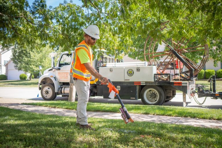
After that, you can begin scanning the ground with the GPR unit. This involves taking a cross sectional approach, moving the unit in a grid-like pattern across the ground and constantly monitoring the data from the GPR readings. As you move the device across the ground, it will detect any objects buried within the earth.
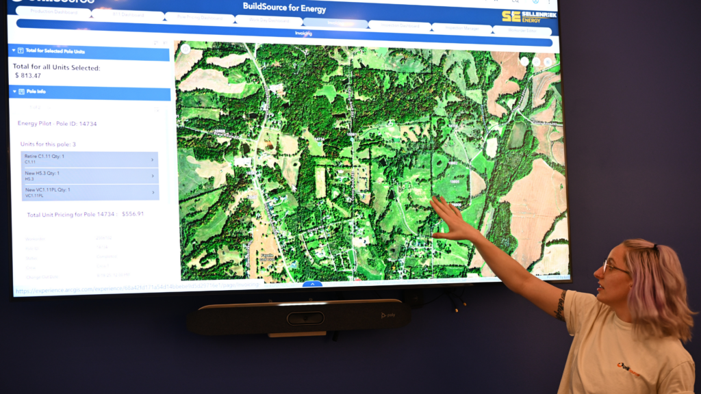
Once you’ve finished the ground-scanning process, the next step is interpreting the GPR data and presenting it in an easy to understand format. The software that accompanied the GPR unit will help you do this, displaying the data collected on a map of the area. This map will contain solid lines (representing layers of earth) and labeled icons (representing the objects detected) so that anyone can quickly identify and understand what the GPR survey revealed.
The last step of the process is to utilize these GPR survey results and make the necessary changes or repairs to underground assets. This is typically done by an underground infrastructure specialist, such as a plumber, electrician or civil engineer. This expert is able to look at the data from the GPR survey and make the needed adjustments to keep the underground utilities functioning properly.
4 Key Benefits of GPR for Utility Mapping
1. Noninvasiveness
One of the biggest benefits of using GPR is that it is non-invasive. The radar signals are sent out from a handheld device or small vehicle, and the signal is reflected back to the surface. This means that there is no need to dig into the ground or disrupt the surface of the area.
2. Precision
Ground penetrating radar systems are extremely precise. The radar waves can penetrate up to 20 feet into the ground, and they can detect man-made changes in the earth. This allows for exact localization of objects and utilities.
3. Cost Effectiveness
GPR is cost-effective. Since GPR does not require excavation or digging, it is a much less expensive process than traditional utility detection methods.
4. Time Efficiency
GPR can save you time during utility mapping projects. Rather than having to manually search for utilities in the ground using probing and excavation, GPR can help quickly identify utilities with minimal effort.
UtiliSource: Expert Utility Mapping Services
When it comes to utility mapping, GPR is an incredibly effective and reliable tool for finding underground infrastructure. While you can rent ground penetrating radar tools, hiring expert utility locating services is the superior solution for utility mapping compared to GPR rentals. By utilizing the advantages of GPR and having a knowledgeable and experienced technician perform the survey, businesses can have clarity and reassurance of the safety and integrity of their infrastructure.
Do you need to know what lies beneath the ground before excavation or utility installation? UtiliSource’s expert utility mapping services can help. Using the latest technology, UtiliSource can accurately map out underground utilities in no time. Take action today and contact UtiliSource for your utility mapping needs.