Utility surveys and utility mapping often involve gathering location based information. This is because having a thorough record of utility information is critical for utility engineering, SUE services, utility maintenance, construction, or excavation projects. That being said, GIS mobile applications are a valuable tool for utility management.
Geographic Information Systems (GIS)
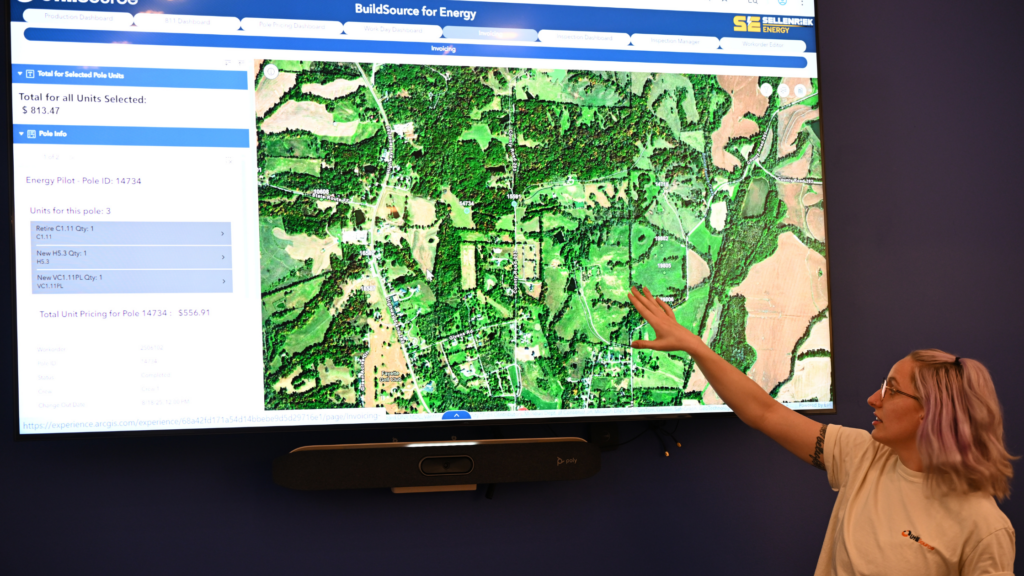
GIS is short for geographic information systems. These are systems that can collect, manage, map, and even analyze all types of geospatial data. GIS software allows viewers to understand the geographic context of the data being collected by connecting raw data to a map.
In the context of utilities management, the ability to collect, track, and visualize utility location data is a huge benefit for communication between workers and project managers and can bring clarity to decision making processes for operators not on site.
GIS Mobile Applications
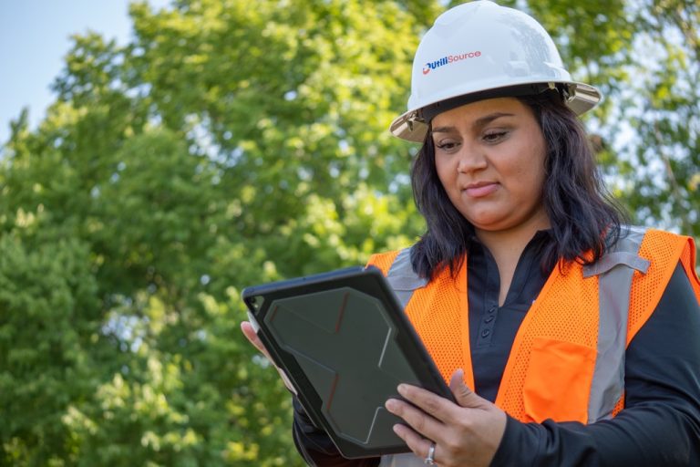
Mobile GIS applications allow you to access spatial data on your mobile devices (including ios and android) at any location. These applications can be used to collect, store, visualize, and even analyze GIS data right from your phone, ipad, or tablet.
Types of GIS Mobile Apps
Mobile GIS apps are categorized by the services they provide. Two of these are real time data collection apps and location based services. These facilitate real time data collection, access to past field data, analysis, and the display of spatial information right from the field site. Having access to historical data and previously developed maps can be extremely useful for ongoing field operations as new data is collected during ongoing field projects.
There is also a type of GIS app that uses augmented reality (AR) services to collect and map geographic data. These AR applications use cameras, GPS, and GIS data to prepare location and site feature displays. These are particularly useful for recording real-world observations.
GIS Mobile App Development
There are several important parts that make up GIS application development. There are two basic sides to every application: the server side and the client side.
The Server Side
There are three “engines” within each mobile GIS server. First, the web engine is what provides map functionality for the mobile application. Next is the map engine, which moves the collected data to the web services that integrate the data into maps. Finally, the data engine is what allows the organization and management of the spatial data.
Client Side
The client side involved both hardware and software to run the mobile application. The hardware would be the GPS capabilities of the mobile device, which is what allows it to connect to GIS servers and draw out spatial data. The installed software is how the mobile device will connect and interact with the mobile application. It also includes the user interface, which is where data collection, map building, and analysis takes place.
Benefits of GIS Mobile Apps for Utilities
Communication
GIS mobile web applications increase communication between field workers, office staff, and stakeholders. When these applications are used, the data collected in real time can be viewed and analyzed by office staff while the workers are still on site. Additionally, understanding the geographic context of raw data can increase operators and managers’ understanding of on-site conditions. More informed decisions can be made, and keeping track of project status is made easier.
Project Efficiency
Efficiency is key for any field-based operation, and GIS mobile applications open the door for maximized efficiency. For example, operation managers can provide a mobile-device accessible GIS map of the field work site, and distribute work zones for different workers with maps displayed on their phone or tablet. Additionally, if the flow of the project needs to get redirected, real-time updates to maps are made much easier.
Utility Information Records
Using mobile GIS applications for field work during utility surveys, SUE projects, and utility maintenance helps develop more thorough and detailed records for future work. Collecting and uploading information on-site and in real time can keep workers from missing any details and provides accurate utility locations.
Integrating your utility information into a GIS-based service is over-all beneficial for utility companies. Understanding the geospatial information of your utilities is of the utmost importance, and advances in technology allow this to be done more effectively than ever before.
Choose UtiliSource
Not all GIS systems and applications are created equal, and it is important to choose the right one for your company. Here at UtiliSource, we provide carefully crafted and designed GIS services specifically for utilities services. Our products are configurable to our customers’ needs, ensuring that you have everything necessary to enhance your projects. Learn more about UtiliSource today!