Accurate subsurface utility information is important for civil engineering projects that involve excavation and grading work, especially highway construction. Highway planning is very dependent on quality subsurface utility information in order to carry out projects without damaging utility lines and causing time consuming construction delays. That’s where Subsurface Utility Engineering comes into play.
Subsurface Utility Engineering (SUE)
Subsurface Utility Engineering (SUE) is a branch of engineering that deals with managing risks associated with utilities and their locations. The various aspects of SUE services are high quality utility mapping and utility coordination and relocation designs. It also involves utility condition assessments and cost assessments. These services are valuable for construction project development processes.
SUE Processes
SUE is an intricate engineering process. It starts with creating a plan that determines the scope of the work, the schedule of the project, and risks that may be associated with existing utilities.
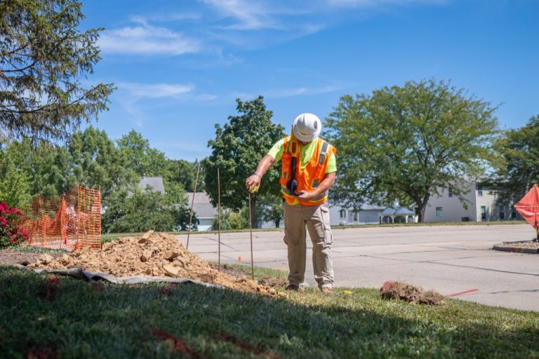
Then, non-destructive surface geophysical approaches are used to evaluate utilities’ existence and horizontal position under the ground. Then, vacuum excavation can be used to determine the vertical position for utilities.
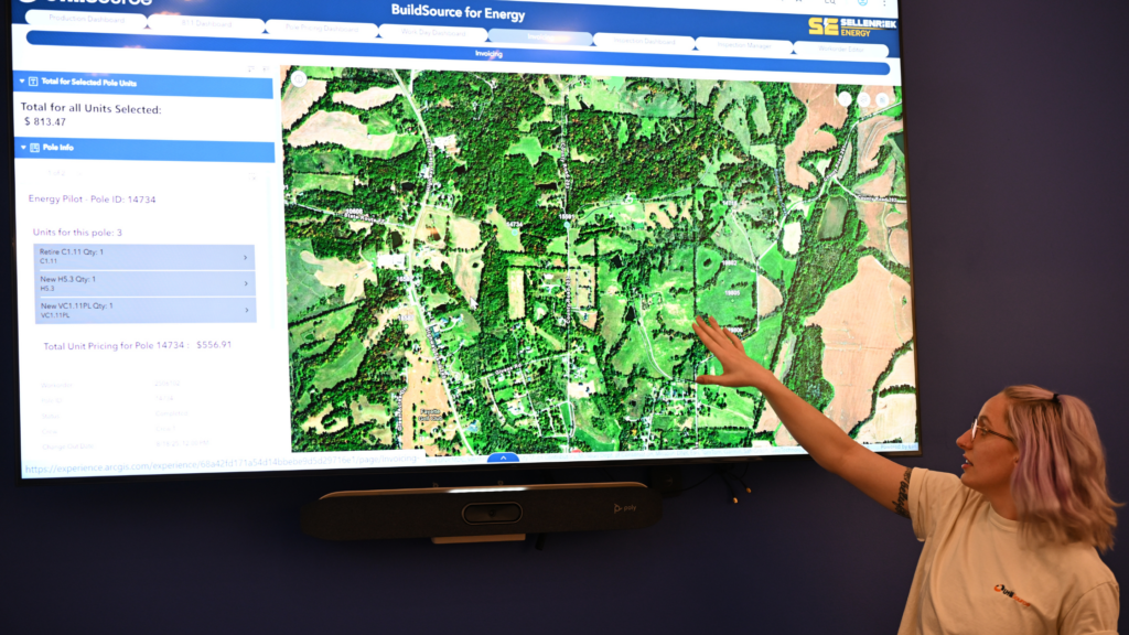
The information provided is usually compiled on a map, and conflict matrices are used to evaluate any potential conflicts with the proposed construction project plans.
Benefits of Proper SUE Practices
The availability of accurate utility information comes with many major benefits for both highway planning and the utilities themselves. First, knowing utility locations means highways can be designed around the utilities, and no relocation during the project will be necessary. Relocations can be costly and time consuming and cause major delays in construction.
Additionally, by having utility information displayed on construction plans and digital maps, project owners can reduce unexpected conflicts with utilities in road plans and begin highway construction more quickly. This also increases safety by eliminating the chance of utility damages that can lead to worker injuries and damaged properties.
Standard Guidelines: ASCE
In 2022, the American Society of Civil Engineers (ASCE) developed and distributed standard guidelines for SUE services. This publication outlines the various aspects of risk management that must be implemented. These include but are not limited to utility condition assessment, high quality utility mapping, utility design, communication of underground utility data, and the adoption of utility accommodation policies.
These guidelines also reaffirm the established methods of gathering of thorough utility background information by performing utility surveys at sites using ground penetrating radar and vacuum excavation approaches to gather high quality levels of utility data.
Quality Levels of Utility Information
Quality of utility information is a big part of determining the risks associated with construction. The degrees of accuracy are directly related to risk because the more information you have the better you can design a project to avoid utility conflicts. The less information you have, the more risk you run. There are four quality levels for subsurface utility information. These range from A-D.
Quality Level A
A-level information quality is the best level of accuracy obtainable for underground utilities. It can be produced by using all available utility engineering services. This includes examining old records, performing utility surveys, finding both the horizontal and vertical position of subsurface utilities, and documenting their size and condition.
Quality Level B
The information gathered to reach level B quality typically comes from the performance of utility surveys to track the location of utilities and their ranges. This can bypass inaccurate utility records and maps while providing enough information to make accurate project planning decisions.
Quality Level C
This level of information most often comes from visual utility inspections and comparisons with existing records. Visible utility landmarks can include manholes and valve or electricity boxes. This is still limited information, but is often the best available for quick planning and rural construction, but the risk of utility conflicts are high.
Quality Level D
This quality level is the lowest and is very limited in the information it provides. This generally means the only available information is old utility records or information from verbal communication. It can be very unreliable, and while it may still provide useful information for the start of project planning, it comes with a lot of risks.
How to Improve your SUE and Utility Mapping Processes
Advances in technology now allow utilities to be displayed on sophisticated maps that can integrate geographic data, landscape qualities, and other important information. Here at UtiliSource, we offer innovative utility mapping services that can enhance your projects and SUE processes exponentially. Check out our website or give us a call to learn more.