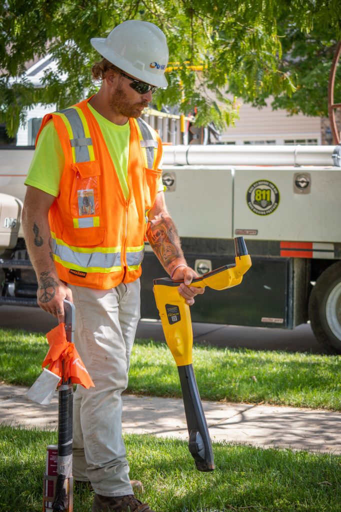
Subsurface utility mapping allows you to know what’s going on underground. It is the process of finding and documenting underground infrastructure such as wires, cables, and pipes.
Utility mapping is important in a variety of industries. Having up-to-date utility data and accurate utility records are important any time you are breaking ground. By knowing existing utility locations, you can prevent damage to underground utilities and protect the safety of your crews.
In recent years, there have been innovations in underground utility mapping. These innovations have improved the quality level of the data. Having high quality data ensures you have access to the highest level of accuracy when mapping underground utilities. These innovations have revolutionized the utility mapping industry.
Automation
One of the biggest innovations in this space has been automation technologies. It is well-documented that automating manual processes saves your crew’s time and your company money.
By utilizing automation in your utility mapping processes through software can significantly reduce operational costs and increase company efficiency. Automated processes save time and money, reduce the errors, and increase data accuracy.
In addition, automation in the equipment itself allows your crews to capture huge amounts of data quickly. Your crews on the ground will be able to reach more areas and hard-to-reach areas faster and safer.
Efficient Workflows
Technology in utility mapping can streamline your operations and increase efficiency. They can optimize your workflows and increase access to the most up-to-date information.
With cloud-based data collection software, your crews can access the information they need in real time. Communication between field crews and the backoffice is easier than ever. Projects can be completed faster. Implementing this technology can help you digitize workflows, save time, reduce the utility strikes, and save money.
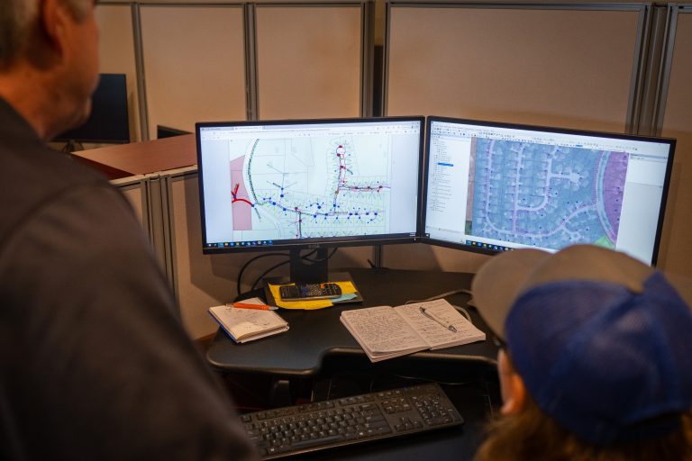
Data Visualization
Innovations in data visualization have changed the utility industry for the better. With the advancement of technology, these tools allow you to easily gather insights from collected utility data.
With data visualization, you can analyze and view your data quickly and easily. Photos of the site may accompany the data, along with location features. Having all of this information at your fingertips reduces the need to visit remote areas physically.
These visualization models often also include predictive analysis. This will further aid in important decision making during the project.
Data Collection
Another huge advancement in utility mapping comes in the form of data collection itself. Developing softwares has revolutionized asset management with easy-to-use interfaces. These interfaces allow you to collect and store information about your most important assets.
This leads to better predictive maintenance and longer equipment lifespans. In addition, these systems remove the need for manual data entry and automate the entire asset management process. Eliminate delays and keep your utility mapping equipment running.
Damage Prevention
By utilizing the most up-to-date equipment, you can ensure accuracy of your utility maps and prevent damage. When you know what’s going on underground excavation projects are much safer. With the most accurate data, you can plan ahead and avoid costly mistakes.
In Summary
Advancements in utility mapping have led to a variety of benefits. These benefits include more accurate data, more efficient workflows, better insights, and more.
Reduce utility strikes and protect important infrastructure with subsurface utility mapping.