Advances in technology are always aimed at improving the traditional way of doing things and enhancing the efficiency of any operation. Because of the importance of utility surveying for construction of underground utility networks, recent developments in software and technologies for performing and documenting such surveys have been game-changers for the industry.
The goal of utility surveying, particularly for underground networks, is to track the locations underground of infrastructure such as electric or fiber optic cables, sewers, pipes, and other utilities. This allows a map to be created, and is a critical step before any construction, maintenance, or excavation operation begins.
Underground Utility Surveying
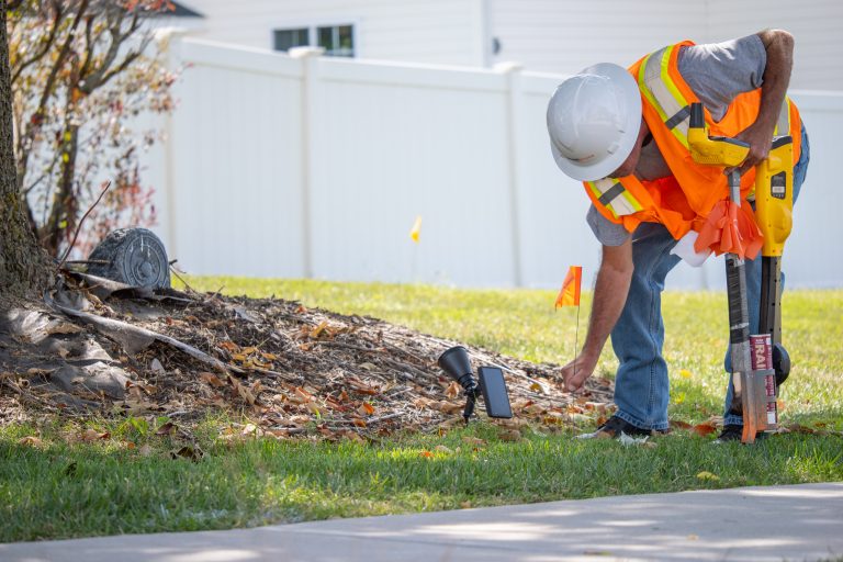
There are two main types of underground utility surveys that each serve a different purpose but are often used together. These are the Radio Frequency Location (RFL) surveys, and Ground Penetrating Radar (GPR) Surveys.
Radio Frequency Location (RFL) Surveys
RFL surveys are one of the most widely used methods for mapping underground utilities. This approach transmits signals into the ground, and traces signals emitted back to the scanner from the underground infrastructure.
This approach is limited to metallic pipes and cable infrastructure. The material being detected must emit some kind of signal and have electrical properties in order to be detected. However, many underground utilities used today do meet these requirements. This includes electricity cables, cables, metallic fuel pipes, and more.
Ground Penetrating Radar (GPR) Surveys
GPR methods for mapping underground infrastructure sends frequency waves underground to produce images of what is under the surface, finding utility locations. It can reach depths of 100 feet depending on the material being detected, seeking to track electromagnetic energy contrasts between the material and surrounding environment.
This approach is versatile in the types of infrastructure it can detect, and is not limited to metallic materials. This includes plastic or PVC pipes, fiber optic cables, and concrete pipes/structures.
The operation of GPR can be influenced by ground and soil conditions, and the proper use of the equipment is necessary for accurate results. It may not be as exact as RFL, but its usefulness in detecting alternative materials makes it a very important tool for subsurface utility surveys.
Advanced Software Enhances Utility Surveying Operations
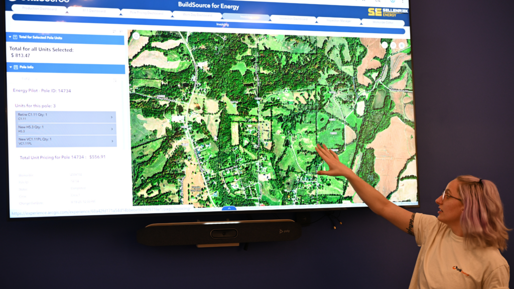
Regardless of what surveying types are being used, utility surveying software has the ability to transform your operation. Advanced softwares can streamline your workflow, and maximize field work and data sharing efficiency.
Benefits of using Advances Surveying Software
Improving Daily Task Management
By setting up apps and other softwares that simplify data acquisition, organize tasks priorities, and promote better communication between personnel, operations can be more efficiently managed and daily productivity can be increased.
It is not uncommon for surveying operations to involve repetitive routine tasks such as staking, checking in on reference lines, and mapping a variety of utility types. Surveying software can help to organize workflows that can help manage time and effort put into daily routines. For example, by using an integrated map, the order of field sites to visit within the day can be adjusted to reduce travel times.
Maximizing the Value of Your Utility Surveying Data
Some of the best surveying softwares have the ability to create and update interactive 3D maps in real time using GIS technologies. Such software can merge data tables containing spatial and descriptive location information to produce these maps, organize the data being collected by location, and provide the ability to create versatile labels that make data linked to the map more informative.
Accessibility of Critical Utility Surveying Information
Utility mapping and the associated qualitative data that is collected real time by field technicians during underground utility surveys can be easily accessible by managers and other stakeholders to keep track of field operations. This facilitates a valuable increase in information sharing, which results in quick, informed decisions to be made about current and future processes or changes that need to take place. This is particularly important for when damages have occurred or when maintenance to underground infrastructure needs to take place.