Before any excavation or construction work begins, it’s important to know exactly what’s buried beneath the surface. Hidden below our streets and yards are complex networks of pipes, cables, and other utility lines. Accidentally damaging these systems can be dangerous and expensive. That’s where ground penetrating radar equipment (GPR) becomes a valuable tool.
GPR is a non-invasive scanning method that helps utility companies and contractors safely locate underground structures without having to dig. It improves the accuracy of utility mapping and helps prevent costly mistakes during construction projects.
How Ground Penetrating Radar Works
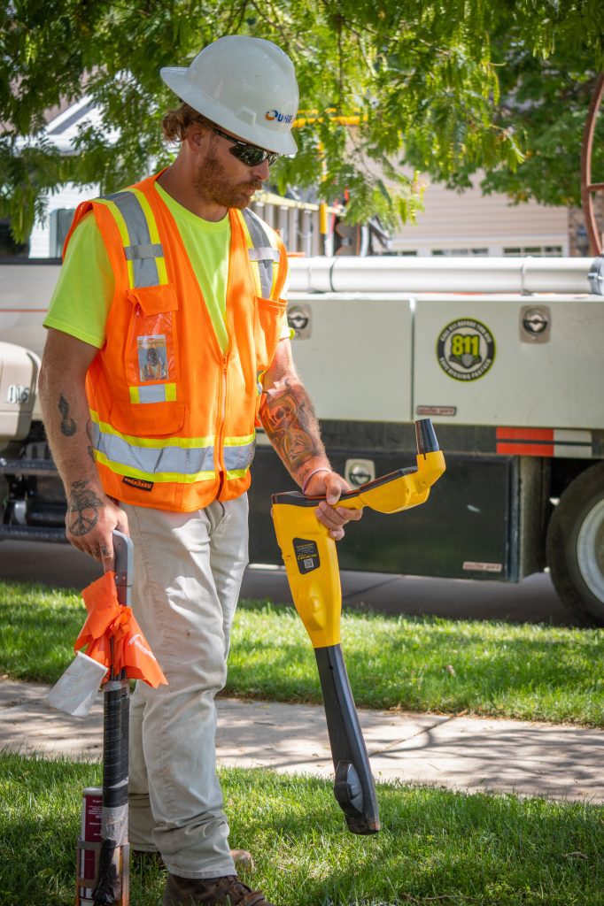
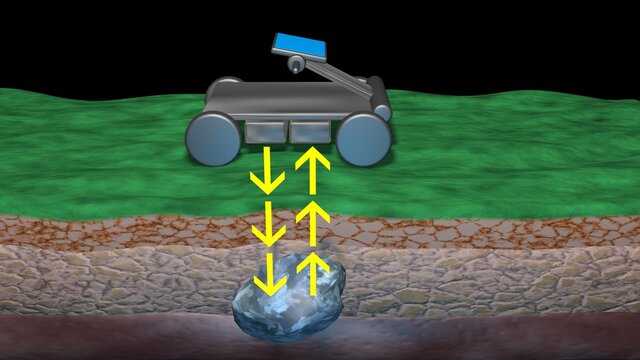
Ground penetrating radar equipment uses radar pulses to detect changes in materials below the ground. When a technician moves the GPR device across a surface, it sends electromagnetic waves into the soil. These waves bounce back when they hit something different, such as metal, plastic, or concrete.
The returning signals are recorded and displayed as a visual map, allowing users to see what lies underground. This helps them determine the depth and shape of buried objects, like utility lines or voids in the soil.
What Can GPR Detect?
GPR equipment is useful for locating a wide range of underground features, including:
- Utility lines made of plastic or metal
- Water and sewer pipes
- Concrete structures
- Voids or air pockets
- Buried tanks or drums
- Foundations or footings
- Changes in soil composition
Because it can detect both metallic and non-metallic materials, GPR is especially valuable in areas where traditional locating methods (like electromagnetic locators) may not work.
Advantages of Using GPR in Utility Mapping
Ground penetrating radar equipment offers several benefits for utility mapping, construction, and damage prevention:
Non-Destructive
GPR does not disturb the ground. It scans from the surface and provides immediate results, making it a safer alternative to trial digging.
Accurate and Reliable
Modern GPR systems provide detailed images that help utility crews locate infrastructure with high precision. This reduces the chance of striking unknown utilities.
Works in Complex Environments
GPR can be used in areas where maps are outdated, or where utility lines cross paths with other underground structures. It’s also helpful in older neighborhoods with mixed utility materials.
Saves Time and Money
By reducing the need for exploratory digging and minimizing the risk of damage, GPR helps projects stay on schedule and within budget.
Limitations of Ground Penetrating Radar
While GPR is powerful, it does have a few limitations:
- Soil conditions matter: Wet or clay-heavy soil can reduce the effectiveness of radar signals.
- Depth range varies: Most GPR systems can scan between 1 and 15 feet deep, depending on the equipment and material type.
- Requires trained operators: Interpreting GPR data requires experience to avoid misreading reflections or false positives.
Because of these factors, many companies choose to pair GPR with other utility locating tools or consult trained specialists for best results.
When Should GPR Be Used?
GPR is commonly used before digging, drilling, or building on any site. It’s especially useful when:
- Old utility maps are missing or unclear
- You’re working in urban areas with dense infrastructure
- You need to identify non-metallic lines like PVC or concrete
- There are concerns about underground voids or sinkholes
- You’re locating lines beneath pavement, concrete, or asphalt
It’s a go-to solution for engineers, utility companies, construction crews, and environmental consultants.
UtiliSource and Ground Penetrating Radar Services
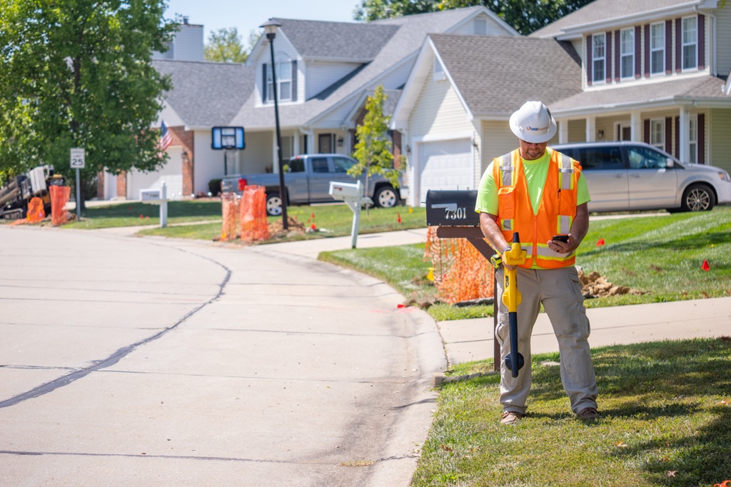
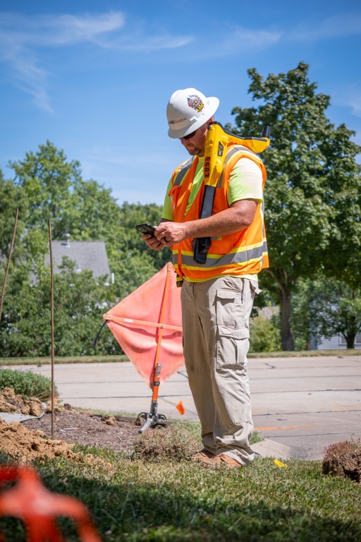
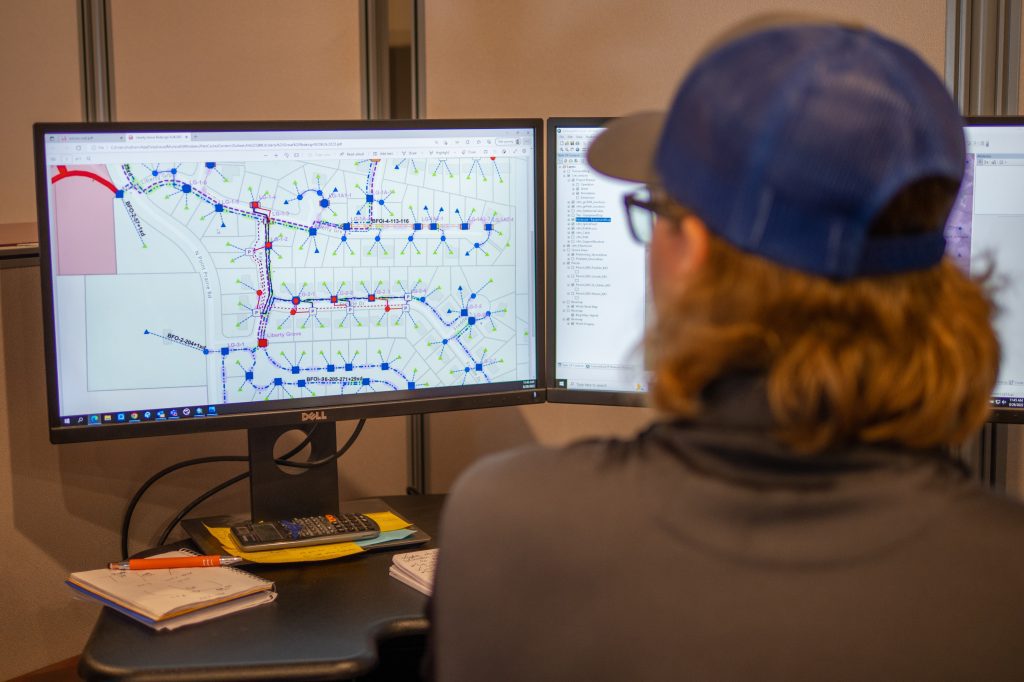
For utility contractors and municipalities, accurate underground mapping is essential. UtiliSource supports this effort by integrating advanced tools—including ground penetrating radar—into its utility mapping and data collection services.
UtiliSource’s experienced field teams use a combination of GPR and other locating technologies to identify buried infrastructure with greater accuracy. This helps reduce locate tickets, avoid excavation damage, and improve project timelines. Their solutions support city planners, engineers, and utility providers with real-time data and reliable field support.
Whether you’re planning a large infrastructure project or simply want to reduce risk during excavation, UtiliSource’s mapping services can help make sure every dig is a safe one.
Key Takeaways
Ground penetrating radar equipment plays an essential role in modern utility mapping. It helps crews see what’s underground without digging and prevents damage to important infrastructure. While GPR does have limitations, it is highly effective when used correctly and paired with other methods.
With support from providers like UtiliSource, contractors and municipalities can rely on accurate data and advanced scanning tools to make better decisions—and dig with confidence.
Before any excavation or construction work begins, it’s important to know exactly what’s buried beneath the surface. Hidden below our streets and yards are complex networks of pipes, cables, and other utility lines. Accidentally damaging these systems can be dangerous and expensive. That’s where ground penetrating radar equipment (GPR) becomes a valuable tool.
GPR is a non-invasive scanning method that helps utility companies and contractors safely locate underground structures without having to dig. It improves the accuracy of utility mapping and helps prevent costly mistakes during construction projects.
How Ground Penetrating Radar Works
Ground penetrating radar equipment uses radar pulses to detect changes in materials below the ground. When a technician moves the GPR device across a surface, it sends electromagnetic waves into the soil. These waves bounce back when they hit something different, such as metal, plastic, or concrete.
The returning signals are recorded and displayed as a visual map, allowing users to see what lies underground. This helps them determine the depth and shape of buried objects, like utility lines or voids in the soil.
What Can GPR Detect?
GPR equipment is useful for locating a wide range of underground features, including:
- Utility lines made of plastic or metal
- Water and sewer pipes
- Concrete structures
- Voids or air pockets
- Buried tanks or drums
- Foundations or footings
- Changes in soil composition
Because it can detect both metallic and non-metallic materials, GPR is especially valuable in areas where traditional locating methods (like electromagnetic locators) may not work.
Advantages of Using GPR in Utility Mapping
Ground penetrating radar equipment offers several benefits for utility mapping, construction, and damage prevention:
Non-Destructive
GPR does not disturb the ground. It scans from the surface and provides immediate results, making it a safer alternative to trial digging.
Accurate and Reliable
Modern GPR systems provide detailed images that help utility crews locate infrastructure with high precision. This reduces the chance of striking unknown utilities.
Works in Complex Environments
GPR can be used in areas where maps are outdated, or where utility lines cross paths with other underground structures. It’s also helpful in older neighborhoods with mixed utility materials.
Saves Time and Money
By reducing the need for exploratory digging and minimizing the risk of damage, GPR helps projects stay on schedule and within budget.
Limitations of Ground Penetrating Radar
While GPR is powerful, it does have a few limitations:
- Soil conditions matter: Wet or clay-heavy soil can reduce the effectiveness of radar signals.
- Depth range varies: Most GPR systems can scan between 1 and 15 feet deep, depending on the equipment and material type.
- Requires trained operators: Interpreting GPR data requires experience to avoid misreading reflections or false positives.
Because of these factors, many companies choose to pair GPR with other utility locating tools or consult trained specialists for best results.
When Should GPR Be Used?
GPR is commonly used before digging, drilling, or building on any site. It’s especially useful when:
- Old utility maps are missing or unclear
- You’re working in urban areas with dense infrastructure
- You need to identify non-metallic lines like PVC or concrete
- There are concerns about underground voids or sinkholes
- You’re locating lines beneath pavement, concrete, or asphalt
It’s a go-to solution for engineers, utility companies, construction crews, and environmental consultants.
UtiliSource and Ground Penetrating Radar Services
For utility contractors and municipalities, accurate underground mapping is essential. UtiliSource supports this effort by integrating advanced tools—including ground penetrating radar—into its utility mapping and data collection services.
UtiliSource’s experienced field teams use a combination of GPR and other locating technologies to identify buried infrastructure with greater accuracy. This helps reduce locate tickets, avoid excavation damage, and improve project timelines. Their solutions support city planners, engineers, and utility providers with real-time data and reliable field support.
Whether you’re planning a large infrastructure project or simply want to reduce risk during excavation, UtiliSource’s mapping services can help make sure every dig is a safe one.
Key Takeaways
Ground penetrating radar equipment plays an essential role in modern utility mapping. It helps crews see what’s underground without digging and prevents damage to important infrastructure. While GPR does have limitations, it is highly effective when used correctly and paired with other methods.
With support from providers like UtiliSource, contractors and municipalities can rely on accurate data and advanced scanning tools to make better decisions—and dig with confidence.