Before any excavation, construction, or infrastructure work begins, one of the most important steps is locating and mapping electrical utilities. Failing to do so can cause serious problems—from power outages and costly damage to safety hazards for workers and the public. For cities, contractors, and utility companies, having accurate underground maps is no longer optional. It’s a necessity.
Utilisource helps solve this challenge by providing smart, scalable solutions to locate and document critical electric infrastructure. Our technology and field expertise offer clarity when it matters most—before the first dig or design decision is made.
Why Locating Electrical Utilities Matters
Most electrical utilities run underground in urban and suburban areas. Over time, records become outdated, cables are rerouted, and assets can be forgotten. Relying on old maps or “as-builts” often leads to surprises in the field.
Here’s what’s at stake:
- Safety: Contact with underground electrical lines can be deadly. Workers face risks of shock or electrocution without proper knowledge of line locations.
- Cost: Damaging a buried cable can require emergency repairs and service interruptions that cost thousands or more.
- Delays: Projects often grind to a halt if utility strikes occur or if missing documentation holds up permits.
- Compliance: State and federal regulations increasingly require pre-dig locating and utility coordination to avoid incidents.
The first step toward avoiding these outcomes is accurate and verified location data. That’s where subsurface mapping comes in.
Tools for Locating Buried Electrical Utilities
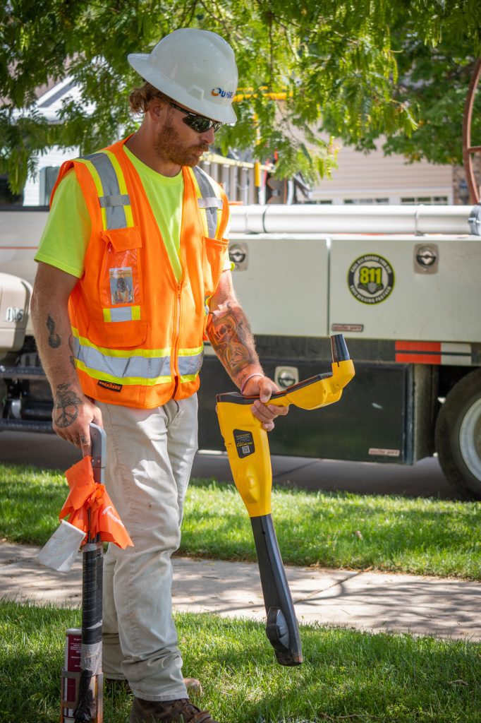
To map underground electric lines, field crews use several technologies that detect, trace, and confirm line locations. These include:
- Electromagnetic Locators: These tools detect signals emitted from active electrical cables. When tracer wires are installed alongside non-metallic lines, the signal can also trace those.
- Ground-Penetrating Radar (GPR): GPR sends radar pulses into the ground and detects changes in materials, helping find utilities that do not emit signals.
- Vacuum Excavation (when needed): For high-risk areas or to confirm exact location and depth, crews may expose utilities using soft-dig techniques.
- GIS Mapping Software: Once located, all line data is imported into digital platforms that track position, material type, depth, and other metadata.
Together, these tools create a complete picture of the underground electrical system. The result is more than a static map—it’s a living record that supports planning, construction, and long-term asset management.
How Data Is Collected and Used
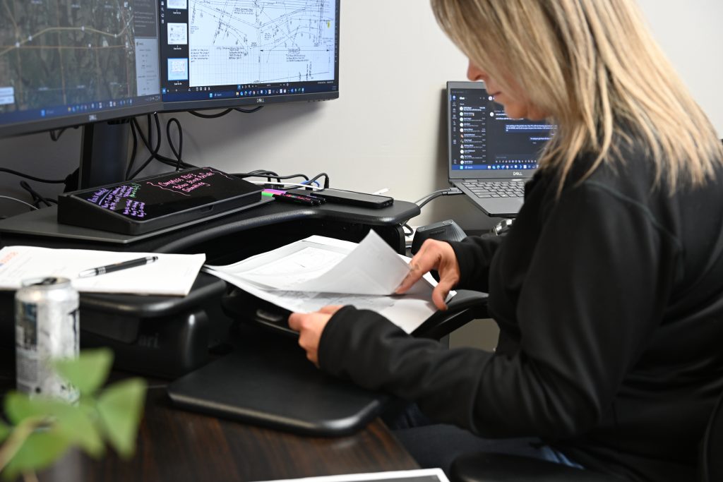
Locating utilities is only the first half of the process. The real value comes when the data is recorded and maintained using proper systems. Utilisource integrates field-collected data into smart mapping platforms that store each utility’s details in real time.
Each asset entry may include:
- Line type (primary, secondary, service drop)
- Depth and exact GPS coordinates
- Date of verification
- Detection method used
- Condition or anomalies noted
- Associated permits or ticket numbers
With this information, engineers, planners, and inspectors can make informed decisions faster and reduce duplication of work.
How Utilisource Supports Cities and Utilities
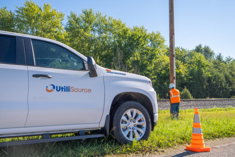
Utilisource is built around one goal: to make utility infrastructure smarter, safer, and easier to manage. When it comes to locating and mapping electrical utilities, we deliver end-to-end services that combine skilled field crews with advanced GIS solutions.
Our services include:
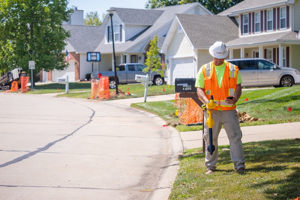
- Utility Locating Support: We assist municipalities in managing 811 utility tickets, reducing overload on in-house teams.
- Subsurface Utility Mapping: We generate precise digital records for electrical and other underground utilities using trusted detection tools.
- GIS Integration and Data Maintenance: Once lines are located, we upload and format the data into systems that match each client’s preferred platform.
- Asset Management Solutions: We help utilities organize, update, and access their entire infrastructure portfolio with cloud-based mapping tools.
Whether a city is facing a flood of dig requests or a utility provider needs to verify its network for expansion, our team acts as an extension of their workforce—without the long-term overhead.
Use Case: Helping Reduce Missed Electrical Tickets
One of the most frequent challenges our clients face is responding to high volumes of dig requests, especially in high-growth areas. Utilisource has helped cities streamline this process by proactively mapping high-density utility corridors. When these maps are digitized and tied to the 811 response system, the locating process becomes faster and more accurate.
In areas with outdated records, our teams perform utility sweeps to identify electrical lines that were never properly documented. After validation, this data is uploaded and used to reduce missed locates and emergency calls.
These services not only lower risk, but they also free up city staff to focus on higher-value tasks.
Conclusion
Accurate locating and mapping of electrical utilities is no longer a luxury—it’s essential for safe, efficient, and regulation-compliant infrastructure work. With the right tools and partners in place, cities and utility providers can avoid costly errors and keep projects on schedule.
Utilisource brings together cutting-edge technology, expert field teams, and seamless GIS integration to give you the visibility you need beneath the surface. Our solutions help cities, engineers, and utility companies reduce risk, eliminate guesswork, and manage underground assets smarter. Whether you’re preparing for a major capital project or simply need to handle today’s 811 tickets more effectively, we’re here to help.