Utility maps can provide valuable information about what may be underground, where facilities are expected to run, and how existing infrastructure could affect a project. However, not every line displayed on a map carries the same level of certainty.
A recently verified facility location is different from a line transferred from an older plan. A visible utility feature provides different information than a geophysical investigation. Even physical exposure generally confirms a facility at a specific location, not necessarily along its entire route.
For that reason, the better question is not simply, “Is this map accurate?” It is: What is this information based on, how current is it, and is its level of confidence appropriate for the decision being made?
Understanding those differences helps project teams know when existing information may be sufficient for early planning and when field verification of utilities should occur before design or construction moves forward.
Utility Map Accuracy Is Not One Universal Standard
Utility records are created for different purposes and at different stages of a facility’s life.
Some records may support general system management. Others may reflect proposed construction, completed work or information collected during a field investigation. A map can still be useful without providing the precision needed for every project decision.
Its value depends on several factors:
- Where the information originated
- When it was collected or last updated
- Whether it represents a proposed or installed facility
- How the location was established
- Whether later changes were documented
- Whether the map reflects horizontal location, depth, or both
Instead of treating every mapped line as equally reliable, project teams should evaluate the source and confidence of the information. This approach allows a utility map to support planning without asking it to provide more certainty than the underlying data can support.
Different Sources Provide Different Levels of Information
Underground utility mapping may bring together several types of records and field observations. Each contributes something different.
Legacy plans and records
Older construction plans, as-builts, and archived drawings may provide important historical context. They can show where a facility was intended to be installed or how a system was documented at the time.
However, those records may not capture every field adjustment, repair, relocation, or later addition. Older documents may also use reference points that have since changed or may not align cleanly with a modern GIS environment.
GIS records
GIS can centralize facility information and make it easier to view, manage, and share. It can also connect mapping with project documents, field updates, and operational workflows.
Still, GIS is only as dependable as the information entered into it. Moving an older record into a modern digital platform does not automatically improve the accuracy of the original location. The record’s source, date, and verification status remain important.
Visible features
Manholes, valves, pedestals, hydrants, meters and other surface features can help teams understand how a utility system may be arranged. They provide useful reference points, but they do not always reveal the exact route between those points.
A line drawn between two visible features may be a reasonable planning assumption, but it should still be identified as an interpretation unless its path has been confirmed.
Geophysical investigation
Field investigation methods can help detect indications of buried facilities and provide more current information than records alone. The results can help teams compare documented locations with actual field evidence and identify possible conflicts.
However, an indication does not always establish every detail about a facility. Ownership, operating status, material, and depth may require additional information or investigation.
Physical exposure
Physical exposure can provide the strongest confirmation of a facility at a particular location. It may verify horizontal position, depth, material, or other characteristics needed for design and construction.
Even then, the finding is specific to the point exposed. Teams should avoid assuming that a utility maintains the same alignment or depth across an entire project area without enough supporting information.
Warning Signs That Records May Not Match the Field
Certain conditions should prompt a closer review of existing utility records. These may include:
- Surface features that do not align with the mapped route
- Multiple records showing different locations for the same facility
- Missing dates, sources, or verification notes
- Facilities shown as proposed without confirmation of final installation
- Evidence of previous construction, repairs, or roadway changes
- Utility markings that conflict with engineering or GIS records
- Congested corridors where several systems occupy limited space
- Field conditions that differ from what the design anticipated
A discrepancy does not automatically mean the entire map is unreliable. It does mean the team should stop, document what does not align, and determine whether additional verification is needed.
When Should Utilities Be Field-Verified?
The required level of verification should match the potential consequences of uncertainty.
Existing records may be adequate for conceptual planning, route comparison, or early project discussions. More detailed field verification may be appropriate when information will influence excavation, bore planning, final design, permitting, conflict resolution, or another decision that depends on a facility’s actual position.
Verification should also be considered when:
- Records are incomplete, outdated, or difficult to interpret
- The project enters a congested utility corridor
- Proposed work will cross or closely approach an existing facility
- Field observations conflict with available mapping
- An important design decision depends on utility depth or alignment
- Uncertainty could create safety, schedule, or rework concerns
Not every utility needs to be exposed across its full length. The goal is to resolve the specific uncertainty that could affect the work. That may involve reviewing additional records, conducting a field walkout, performing geophysical investigation, or physically exposing a facility at a critical location.
What Field Verification Can Reveal
Field verification can uncover conditions that are difficult, or impossible, to identify from records alone.
A facility may be missing from the available mapping. An abandoned line may still remain underground. A utility may have been relocated without the final location reaching every record system. A documented alignment may reflect the original design rather than the route installed in the field.
Verification may also reveal unexpected depth changes, undocumented crossings, or additional facilities within a crowded work area.
These findings are valuable beyond the immediate project. They can help engineers refine designs, allow project teams to address conflicts earlier, and provide GIS teams with better information for future planning.
Verified Information Should Return to the System
Field verification delivers its greatest long-term value when the results do not remain isolated in a field notebook, email, or project folder.
Confirmed locations and documented changes should flow back into engineering drawings, project maps and GIS records through a defined update process. The record should also retain useful context, including how the information was collected, when it was verified, and what limitations remain.
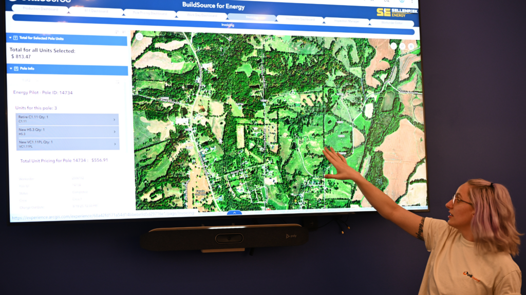
This closes the loop between planning and field execution. UtiliSource’s broader project workflow, from high-level design and field walkouts through production mapping, red lines and GIS cleanup, illustrates why information must continue moving as conditions become better understood.
Without that feedback loop, teams may encounter the same uncertainty again on the next project.
Better Decisions Begin With Better Context
A utility map does not need to answer every possible question to be useful. It does need to communicate what is known, where the information came from, and how much confidence the project team should place in it.
By matching verification efforts to project risk and returning confirmed findings to engineering and GIS, organizations can build a more dependable information base over time. That supports clearer planning, better coordination, and fewer surprises when work reaches the field.
Not necessarily. A GIS line may be based on a legacy plan, an as-built record, an estimated route, or field-verified information. Its source, date, and verification status should be reviewed before it is used for a precision-dependent decision.
No. The appropriate method depends on the question being answered and the consequences of uncertainty. Record review, visible features, and geophysical investigation may provide sufficient information in some situations. Physical exposure may be appropriate at critical crossings or where precise location and depth are needed.
No. Physical exposure confirms conditions at the location investigated. Alignment and depth may change elsewhere, so the finding should be interpreted within its documented limits.
Records can become unreliable when construction changes, repairs, relocations, or abandoned facilities are not fully documented. Older plans may also represent intended construction rather than final installed conditions.
GIS helps organize and visualize facility information so engineering, field, and project teams can work from a shared information base. Its usefulness increases when sources, dates, and verification status are maintained with the mapped features.
When verified field information is incorporated into engineering and GIS records, it creates a stronger foundation for future planning, coordination and design. It also reduces the chance that the same uncertainty will need to be resolved repeatedly.