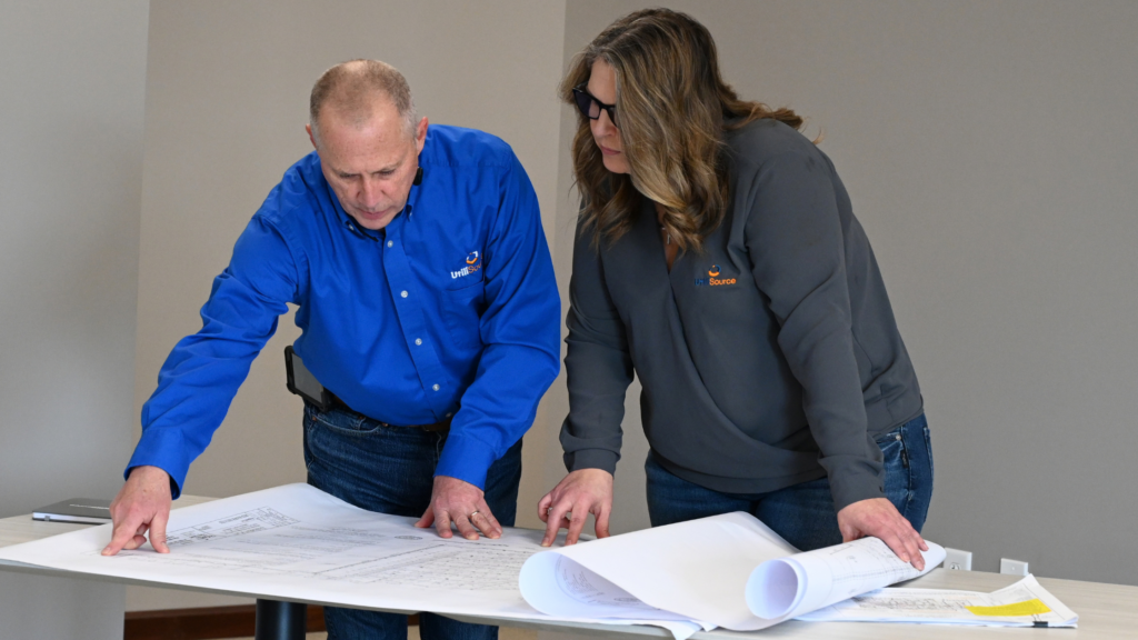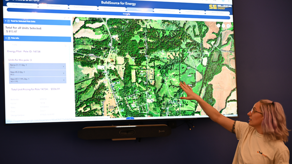
Many organizations already have a geographic information system.
They have software licenses, mapped assets, layers of infrastructure data, and perhaps even a dedicated GIS professional or department. On paper, they have made the investment.
But owning GIS and operating with GIS are not the same thing.
A system can contain years of valuable information and still have little influence on daily decisions. Maps may be created only when someone submits a request. Field crews may rely on printed plans, institutional knowledge, or disconnected files. Engineering, operations, construction, and leadership may each work from different versions of the same information.
In those situations, GIS exists, but it is not yet functioning as an operational resource.
The real value of GIS does not come from having more layers, more software, or more data stored in a database. It comes from making reliable information accessible, understandable, and useful to the people making decisions throughout the organization.
When GIS Becomes Shelfware
“Shelfware” traditionally refers to software that an organization purchases but rarely uses. GIS shelfware can be more difficult to recognize because the system may technically be active.
Someone may maintain the database. Maps may occasionally be produced. Asset information may be updated after a major project. The organization may even point to its GIS platform as evidence that infrastructure records have been modernized.
However, the system may still sit on the operational sidelines.
GIS becomes shelfware when it is treated primarily as a place to store information rather than a tool that supports ongoing work.
Common examples include:
- Asset records that are available in GIS but are not regularly used by field personnel
- Maps that must be requested from one department rather than accessed directly
- Project updates that are collected in the field but take days or weeks to appear in the system
- Engineering files, construction records, and GIS data that are maintained separately
- Dashboards that were developed for a specific initiative but are no longer reviewed
- Staff members who know the system exists but do not know how it applies to their responsibilities
The issue is not necessarily that the technology failed. More often, the system was implemented without a clear plan for how it would become part of everyday operations.
Signs Your GIS Is Not Driving Decisions
An organization does not need to abandon its current GIS platform to improve results. The first step is recognizing where information is failing to move from the system into the decision-making process.
Teams Still Work From Different Information
When engineering, operations, construction, and leadership are working from different maps, spreadsheets, drawings, or reports, GIS is not yet serving as a dependable source of shared information.
Each department may have accurate information within its own files, but the organization lacks a consistent view of current conditions.
That disconnect can create confusion around questions such as:
- Which assets have been verified?
- Which design is current?
- What changed during construction?
- Has field information been incorporated?
- What work has been completed?
- Which records still need review?
A functioning GIS environment should help teams answer those questions more consistently.
Field Crews Do Not Trust the Data
A GIS system is only useful when the people relying on it believe the information is accurate enough to support their work.
When crews repeatedly encounter incorrect locations, outdated records, missing assets, or conflicting details, they may begin relying more heavily on experience and memory than the system.
That response is understandable. Field teams need information they can use with confidence.
Restoring trust requires more than telling employees to use GIS. It requires a process for verifying information, capturing corrections, documenting confidence levels, and updating records as conditions change.
Information Flows in Only One Direction
Some organizations use GIS to send maps into the field but do not have a reliable process for bringing field knowledge back into the system.
That creates a one-way information flow.
Crews may identify discrepancies, find undocumented infrastructure, collect GPS points, or make adjustments during construction. If those findings remain in notebooks, marked-up plans, text messages, or individual files, the organization loses an opportunity to improve its long-term records.
Operational GIS creates a repeatable loop:
- Information is prepared for the work.
- Field teams use and verify it.
- New information is collected.
- Records are reviewed and updated.
- Improved information supports the next decision.
Maps Are Created Only After Someone Asks
Custom maps will always have a place in GIS. However, if employees must contact the GIS department every time they need basic asset or project information, adoption will remain limited.
GIS professionals can become overwhelmed by routine requests, while other teams may avoid using the system because accessing information feels slow or complicated.
Frequently needed information should be available through practical maps, applications, dashboards, or workflows designed around the needs of specific users.
Leadership Receives Static Reports Instead of Current Visibility
Executives, board members, municipal leaders, and project stakeholders do not always need technical GIS tools. They need clear visibility into the information that affects schedules, budgets, risk, priorities, and decisions.
When GIS data remains buried inside technical platforms, leadership may continue relying on manually assembled reports that reflect a moment in time.
Operational GIS can help transform complex spatial and project data into a clearer view of:
- Work completed
- Work remaining
- Asset conditions
- Project locations
- Schedule progress
- Geographic risk
- Service areas
- Permit status
- Field activity
- Areas requiring action
The goal is not to give every leader access to every data layer. It is to present the right information in a format that supports the decisions they are responsible for making.
Why GIS Adoption Fails
Low adoption is often described as a training issue. Training matters, but it is rarely the only issue.
Organizations may provide access to GIS, conduct an initial training session, and expect staff members to incorporate the system into their jobs. When usage remains low, employees may be seen as resistant to change.
In reality, adoption often fails because the system does not fit naturally into the work.
The System Was Built Around Data, Not Users
GIS initiatives frequently begin with questions about available records, data structures, layers, and software capabilities.
Those questions are necessary, but they are not enough.
A successful implementation must also ask:
- Who needs this information?
- What decisions are they making?
- Where does the current process slow down?
- What information do they struggle to find?
- What should happen after new information is collected?
- How quickly do updates need to appear?
- What level of detail does each user actually need?
A field supervisor, engineer, utility locator, project manager, and board member may all benefit from GIS, but they should not necessarily interact with it in the same way.
GIS Adds Steps Instead of Removing Them
Employees are less likely to adopt a system that creates duplicate work.
For example, adoption will be difficult if a crew must record information on paper, enter it into a spreadsheet, email the spreadsheet to another department, and then wait for someone to update GIS.
The system may be technically sophisticated, but the workflow remains inefficient.
Operational GIS should reduce unnecessary handoffs and duplicate entry wherever possible. The goal is to create a more direct path between field activity, review, documentation, and organizational visibility.
Ownership Is Unclear
GIS may be viewed as the responsibility of one person or department, even though the accuracy and usefulness of the system depend on contributions from across the organization.
The GIS team may manage the platform, but engineering, operations, construction, locating, inspection, and project management may all create or verify information that belongs in the system.
Without clear ownership, important questions remain unanswered:
- Who submits updates?
- Who reviews them?
- Who approves changes?
- Who resolves conflicting information?
- Who monitors data quality?
- Who determines which tools or dashboards are still useful?
Shared responsibility does not mean everyone can change everything. It means each team understands its role in maintaining reliable information.
The Organization Tries to Solve Everything at Once
GIS programs can stall when organizations attempt to map every asset, correct every historical record, connect every system, and build tools for every department at the same time.
The size of the initiative creates complexity before users experience meaningful value.
A more practical approach is often to begin with a specific operational problem.
That could include improving field access to asset information, creating a permitting dashboard, documenting construction changes, mapping project progress, or developing a more reliable process for record updates.
A focused use case can demonstrate value, reveal process gaps, and build momentum for broader adoption.
Building Operational GIS
Operational GIS is GIS that has been integrated into the recurring work of the organization.
It does not sit apart from engineering, field operations, project management, locating, construction, or leadership reporting. It connects those functions by helping information move between them.
Building operational GIS begins by shifting the conversation away from what the software can do and toward what the organization needs to do better.
Start With the Decision
Every GIS tool, dashboard, map, or workflow should support a clear question or action.
For example:
- Where are our assets located?
- Which records have been field-verified?
- What work is ready for construction?
- Where are project delays occurring?
- Which permits are outstanding?
- What changed between design and installation?
- What areas require inspection or maintenance?
- What information does leadership need before approving the next phase?
Beginning with the decision helps prevent organizations from developing tools that look impressive but are rarely used.
Connect Planning, Fieldwork, and Documentation
GIS creates more value when it supports the full lifecycle of a project or asset rather than one isolated stage.
Information may begin with high-level design, move into fieldwork and walk-out mapping, support drafting and engineering, contribute to permitting and production maps, and later help document redlines and cleaned-up construction records.
The value comes from maintaining continuity as the work moves between teams.
When each phase begins from disconnected information, the organization spends time rebuilding context. When the phases are connected, each team can build on what has already been collected, reviewed, and documented.
Make Field Data Part of the System
Field data is essential to operational GIS because infrastructure records must reflect real-world conditions.
GPS mapping, RTK data collection, locating information, inspections, photographs, notes, and construction updates can all contribute to a more complete operational picture.
However, collecting more information is not enough. Organizations also need standards for:
- What should be collected
- How it should be collected
- What accuracy is required
- How the information will be reviewed
- When it will be added to the system
- How conflicting information will be handled
A reliable process is what turns field observations into organizational knowledge.
Design Access Around the User
Not every employee needs full GIS editing capabilities.
Some users may need a simple mobile map. Others may need a dashboard, a project-specific application, a production map, or a workflow that allows them to submit updates for review.
Leadership may need a summarized view of project status rather than direct access to technical records.
Effective GIS adoption depends on giving each audience an appropriate way to interact with the information.
Establish a Feedback Loop
Users are more likely to engage with GIS when they can see that their feedback improves the system.
If field teams report an error but the correction never appears, trust declines. If project managers request a dashboard change but the tool remains disconnected from their workflow, usage drops.
Organizations should create a clear process for reporting issues, evaluating requests, making updates, and communicating changes.
GIS should continue evolving as the work evolves.
Creating Daily Value
A successful GIS program does not need to transform the entire organization overnight.
It needs to make recurring work clearer, faster, or more reliable.
Daily value may look like a field employee accessing the latest map without calling the office. It may mean an engineer seeing verified field information before finalizing a design. It may allow a project manager to monitor permitting progress without assembling updates from several sources.
It may help construction teams document changes while the information is still current. It may give municipal leaders a clearer view of infrastructure conditions. It may allow a board member to understand where a project stands without reviewing a stack of technical reports.
These improvements may appear small individually, but together they create stronger coordination and better project visibility.
The most useful GIS environments often become so integrated into daily work that employees stop thinking of GIS as a separate initiative. It simply becomes part of how information is collected, shared, reviewed, and used.
GIS Should Support the Work, Not Sit Beside It
Having GIS is an important first step. Actually using GIS requires a broader commitment to workflows, ownership, accessibility, data quality, and adoption.
The goal is not to force every employee to become a GIS expert.
The goal is to equip each team with reliable information that helps them do their work, communicate across departments, and make better-informed decisions.
Organizations that move from passive GIS ownership to operational GIS can create more value from the investments they have already made. They can reduce information gaps, improve visibility, strengthen records, and connect planning more effectively with what is happening in the field.
At UtiliSource, we focus on practical, customer-centered solutions that help organizations turn information into something their teams can use. GIS is most valuable when it does more than display where assets are located. It should help people understand what is happening, what has changed, and what needs to happen next.
Operational GIS is a geographic information system that has been integrated into the organization’s recurring workflows. It supports practical activities such as planning, design, field data collection, locating, permitting, construction documentation, asset management, project reporting, and leadership visibility.
Rather than serving only as a database or map-production tool, operational GIS helps information move between the people who collect it and the people who need it to make decisions.
GIS projects may struggle when they are built around software capabilities rather than clear user needs. Adoption can also fail when the system creates duplicate work, information is unreliable, ownership is unclear, field updates do not make it back into the database, or employees do not receive tools that fit their responsibilities.
Many GIS challenges are workflow and communication challenges rather than purely technical problems.
Organizations can improve adoption by beginning with a specific operational need, involving users early, simplifying access, reducing duplicate processes, clarifying ownership, improving data quality, and demonstrating how GIS makes recurring work easier.
Training is also important, but it is most effective when employees understand how the system applies directly to their work.
Yes. GIS can help municipalities organize and visualize information related to public infrastructure, utilities, service areas, projects, permits, maintenance needs, and community planning.
Its effectiveness depends on the accuracy of the available information and how well the system is integrated into municipal workflows and decision-making processes.
GIS can provide engineering teams with asset records, geographic context, field observations, survey or GPS information, project boundaries, environmental considerations, and other location-based data that inform planning and design.
Engineering information can then flow back into GIS through updated designs, permitting records, production maps, redlines, and final construction documentation.
Field data helps organizations verify whether their records reflect actual conditions.
GPS points, RTK measurements, locating information, photographs, inspections, notes, and construction updates can improve the accuracy and usefulness of GIS. To create lasting value, that information must be collected consistently, reviewed appropriately, and incorporated into the system in a timely manner.