With the growing complexity of subsurface infrastructure, the need for reliable digital mapping has never been greater. Accurate mapping allows utility companies, facility managers, and project managers to efficiently locate, monitor, and maintain critical underground utilities like water lines, telecommunications networks, and gas pipelines.
UtiliSource, a leader in digital mapping and utility management solutions, plays a vital role in developing and providing state-of-the-art tools that support utility locators in mapping underground utilities. Their technology, including Geographic Information Systems (GIS), electromagnetic (EM) locators, and satellite imagery, helps ensure that communities are safe, project outcomes are successful, and critical infrastructure remains intact.
This post explores the importance of digital mapping in utility management, with a focus on how UtiliSource’s approach to accurate mapping is enhancing outcomes for both utility providers and the communities they serve.
The Importance of Digital Mapping in Utility Management
Mapping is the process of creating visual representations of physical spaces, and for utility management, it involves creating precise maps of underground infrastructure. Mapping underground utilities, such as telecommunications lines, water pipelines, and electric cables, is crucial for a variety of reasons:
- Safety: Accurate mapping reduces the risk of accidental damage to underground utilities during excavation, protecting workers and nearby communities from potential hazards.
- Efficiency: With clear, real-time data on the location of underground utilities, project managers can plan and execute projects more efficiently, avoiding unnecessary delays and costs.
- Resource Allocation: Detailed maps allow facility managers to allocate resources effectively, ensuring that maintenance and repairs are conducted in the most cost-efficient manner.
UtiliSource’s digital mapping solutions integrate advanced tools, such as GIS and EM locators, to help utility locators and project managers access accurate and actionable utility data. By combining mapping tools with real-time updates and satellite imagery, UtiliSource is redefining how utility companies approach infrastructure management.
UtiliSource’s Role in Mapping Utilities for Community Benefit
UtiliSource understands that accurate underground utility mapping benefits more than just the utility companies—it also has a direct positive impact on communities. By providing reliable, real-time data on underground infrastructure, UtiliSource ensures that community projects are carried out smoothly, with minimal disruption to daily life.
- Preventing Service Interruptions: When utility locators have access to accurate utility data, they can prevent accidental strikes to telecommunications lines, water pipes, and other critical infrastructure. This reduces the likelihood of service disruptions that could impact local residents and businesses.
- Supporting Safe Construction Practices: UtiliSource’s digital mapping tools provide project managers with clear insights into subsurface infrastructure, allowing them to plan safer excavation practices. This reduces the risk of accidents and ensures that community projects, such as road repairs or new building construction, proceed without unnecessary delays or hazards.
- Enhancing Emergency Response: In the event of an emergency, such as a gas leak or a water main break, UtiliSource’s real-time mapping data enables facility managers and emergency responders to quickly locate and address the issue. This fast response helps minimize damage, reduce costs, and keep communities safe.
Advanced Tools for Accurate Utility Mapping
UtiliSource leverages a variety of advanced tools and technologies to ensure that utility mapping is both accurate and comprehensive. Here are some of the primary tools they use in their approach to mapping underground utilities:
- Geographic Information Systems (GIS)
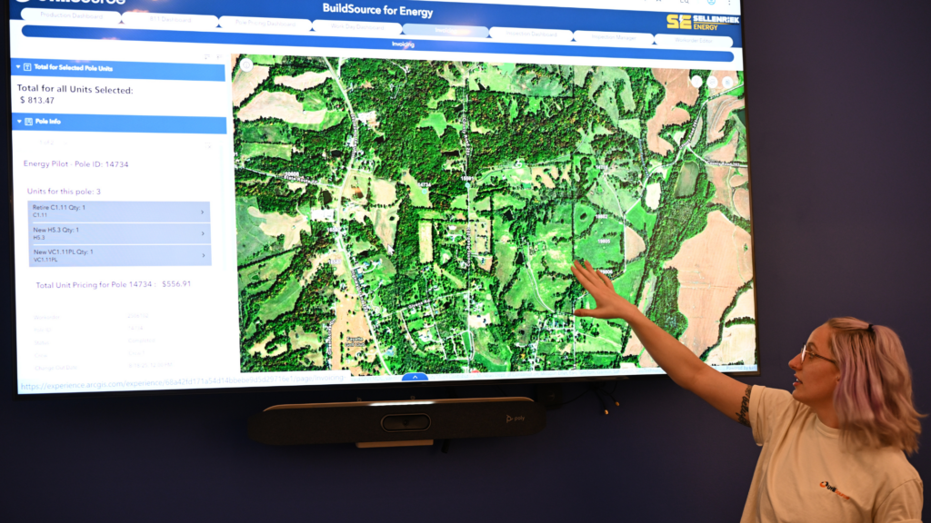
GIS technology serves as the backbone of UtiliSource’s mapping solutions. By integrating data from various sources, GIS provides utility locators with a layered, interactive map of underground infrastructure. GIS allows facility managers and project managers to view the exact location of subsurface utilities, making it easier to plan and execute projects without risking damage.- Interactive Maps: UtiliSource’s GIS-powered interactive maps allow users to toggle between layers, such as telecommunications lines, water pipes, and electric cables. This flexibility gives teams a complete view of the underground infrastructure and allows them to identify potential risks and adjust project plans accordingly.
- Electromagnetic (EM) Locators
EM locators are used to identify the exact location of conductive materials, such as metal water lines and gas pipes. By sending an electromagnetic signal through the ground, EM locators reflect off metallic utilities, allowing utility locators to pinpoint the location of underground utilities without the need for excavation.- Real-Time Accuracy: UtiliSource’s EM locators work in real time, providing instant feedback that helps teams accurately map and avoid critical infrastructure. This accuracy is essential in ensuring that project outcomes are efficient and safe.
- Satellite Imagery and GPS Technology
Satellite imagery and GPS technology are used to enhance UtiliSource’s mapping data, providing a comprehensive view of the environment surrounding underground utilities. Satellite imagery offers a high-level view, making it easier to monitor changes over time, identify potential hazards, and plan new infrastructure routes.- Environmental Context: GPS data enables utility locators to track their exact location and ensure that underground facilities are mapped with precise coordinates. By integrating satellite imagery, UtiliSource provides additional context, allowing project managers to assess factors that may impact project outcomes, such as natural obstacles or land developments.
The Benefits of Digital Mapping for Facility and Project Managers
UtiliSource’s digital mapping tools are designed to support both facility managers and project managers in their day-to-day tasks. Here’s how these tools benefit professionals responsible for managing utility infrastructure:
- Improved Project Planning and Execution: With access to interactive maps and real-time data, project managers can plan projects with a high level of accuracy. This minimizes risks and helps ensure that projects are completed on time and within budget.
- Optimized Maintenance Schedules: Facility managers rely on accurate mapping data to schedule routine maintenance, repairs, and upgrades. UtiliSource’s maps provide up-to-date information on the condition and location of underground utilities, enabling facility managers to make informed decisions.
- Streamlined Resource Allocation: By knowing the precise location of underground infrastructure, project and facility managers can allocate resources more effectively. This reduces unnecessary spending and ensures that teams are deployed in the most efficient manner possible.
Enhancing Community Outcomes Through Accurate Mapping
Accurate utility mapping does more than just protect infrastructure—it also contributes to the well-being and growth of communities. UtiliSource’s commitment to providing reliable, up-to-date maps of underground infrastructure plays a direct role in improving community outcomes:
- Preventing Costly Interruptions: By helping to avoid accidental damage to utilities, UtiliSource’s digital mapping tools prevent disruptions to essential services. This continuity is vital for local businesses and residents who rely on uninterrupted access to water, electricity, and internet connectivity.
- Supporting Sustainable Growth: As communities grow, so does the demand for reliable infrastructure. UtiliSource’s mapping solutions support sustainable community growth by helping utility companies and developers plan new projects with minimal environmental impact and resource use.
- Promoting Transparency and Accountability: UtiliSource’s digital mapping technology promotes transparency by providing clear, accessible data on underground infrastructure. This data can be shared with stakeholders, such as local government agencies, to ensure that community projects align with safety standards and regulations.
Conclusion: UtiliSource’s Impact on Utility Mapping and Community Safety
As a leader in digital mapping and utility management, UtiliSource is transforming the way utility companies approach underground infrastructure. Their suite of advanced tools—including GIS, EM locators, and satellite imagery—provides utility locators, project managers, and facility managers with the data they need to manage utilities efficiently and safely.
By prioritizing accuracy and accessibility, UtiliSource not only improves project outcomes but also enhances community safety and quality of life. Accurate utility mapping is essential for the safe, sustainable development of communities, and UtiliSource is at the forefront of this important work. As technology continues to evolve, UtiliSource remains committed to supporting the utility industry with innovative solutions that drive positive, lasting change for communities across the United States.